A DAY OF "DEEP SURPRISE"
This is the first "quick posting" about yesterday's drilling and sampling work. Others with more detail will follow as each of us "physically recovers" from our respective labors out on the Pond.
We finally got to drilling and sampling yesterday under beautiful blue skies, light winds to start, and temperatures in the 20's most of the day (see photos to be posted here on the blog later today or tomorrow). We got started ferrying loads of equipment to the drilling site around 7:30 AM and had cleared everything except our drilling platform and deep casing from the ice by sundown. It was a lot of hard work, and I want to thank everyone who was involved, including those who braved the cold associated with standing around to video and photograph the process, which yielded some scientifically interesting and unexpected results.
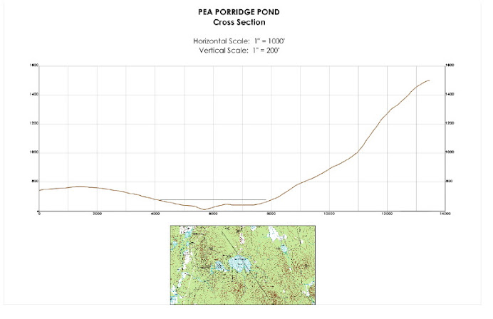
We started drilling in approximately46 feet of water (the deepest spot in the Pond) and took multiple samples below the Pond-bottom to about 20 feet. The samples started off as loosely compacted, richly organic sediments that were somewhat surprisingly free of vegetative debris(leaf shards, pine needles, twigs, etc.), and while these organic-rich sediments became more well- consolidated ("stiffer") with depth, they continued to show this general composition right down to where we quit for the day.

We had not expected to find such an extensive thickness of strictly organic sediment, and in fact thought that by 20 feet beneath the Pond bottom, we'd have finished the drilling and sampling project after intersecting the several layers of much less organic sediment (combinations of sand, silt, & clay) that undoubtedly overlie the compact glacial till or bedrock that forms the Pond's basin. It's clear now that the Pond basin is significantly deeper than we thought, and we plan to continue the drilling and sampling as soon as we can reorganize ourselves for another round to "get to the bottom" of this unexpected situation. Depending on exactly how fast such organic material is deposited (thought to be about 3 feet per millennium...?), it's presently possible that we've penetrated something like 5,000 to 7,000 years of deposition and that we have another 4-5 to go before we get to the bottom of the basin that existed when the last glacial ice left it.
So, the project will continue. We'll keep you advised here on the blog of when we'll be drilling and sampling next. It has to be within the next 2-3 weeks, before the ice thins and can no longer support the drilling platform (and our equipment upon it). Keep your eye on the blog for other postings related to yesterday's activities, some of them with more detailed scientific information and others with observations and photographs of what went on out on the Pond.


1 comment:
Who knows where to download XRumer 5.0 Palladium?
Help, please. All recommend this program to effectively advertise on the Internet, this is the best program!
Post a Comment