The Madison-Hills Paleoecology Project ("MPEP")

Introduction

The MPEP is a privately funded endeavor that will drill and sample the layers of soft sediment that have accumulated in the deepest part of Big Pea Porridge Pond ("BPPP") in Madison, New Hampshire during the past +/- 14,000 years. The purpose of the work is to scientifically analyze, technically describe/catalogue, and radiocarbon/proxy date these progressively deposited materials to establish the ecologic change-sequence history of the Pond's basin since the departure of the last ice sheet. The work described above will begin in late January or early February 2008 and be completed by late Spring or Summer 2008.

Scientific Basis of the MPEP

Lake-bottom sediments represent the most continuously detailed records of post-glacial (Pleistocene to Holocene) climate and environmental change available, and such records provide the best long term context for the dramatic physical and biological/ecological changes that have occurred during what has become to be known as the "Anthropocene" period (time since the beginning of extensive human habitation).

Who's Involved

The scientific staff of MPEP includes the following individuals, all of whom are donating their professional expertise to the project:

P. Thompson Davis, Ph.D., Dept. of Natural & Applied Sciences, Bentley College.
Brian Fowler, Quaternary Scientist, Project Director.
Lee Pollock, Ph.D., Dept. of Biology, Drew University.
Lisa Doner, Ph.D., Center for the Environmental, Plymouth State University


Tuesday, February 26, 2008

Depth Sounding Through Ice Fishing Holes


A group of local ice-fishing folks have set up two bob-houses pretty close to the deep spot estimated from Dennis Deschene's summer depth finder observations. A conversation with them on Saturday revealed that, using their hand-held depth sounder, they had located at least one spot in excess of 48 ft. On Monday, we took advantage of some of their ice fishing holes to generate a depth profile of this area. Having reopened each hole using a crowbar, Sylvia then lowered a weighted line until it touched bottom (as best we could tell), and we recorded the depths observed. While our results don't line up with the fisherman's data precisely, we may not have been using exactly the same locations that they did. Drawing in best-estimate depth contour lines within the pattern of depths recorded, we now have a better idea of where to drill our exploratory holes just before the actually coring gets started on March 8. - Lee Pollock

Saturday, February 23, 2008

Social Posting #3

The social activities that were scheduled for Feb. 23 have been rescheduled to Sat., March 8, to coincide with the drilling. If you have any questions please contact Betsy @ 447-5077 or Sylvia @ 447-2333.

Wednesday, February 20, 2008

Scientific Information Posting No. 5

LIVINGSTONE PISTON SAMPLER

For those of you interested in the sampling device we will be using, its specifications and the procedures for its use can be found via the new link you'll find in the "Useful Links" section here on the blog.

Tuesday, February 19, 2008

Scientific Information Posting No. 4

DRILLING & SAMPLING ON SATURDAY, MARCH 8, 2008

The drilling and sampling portion of the project is now set to be completed on Saturday, March 8th at very close to the deepest spot in the Pond's basin. The work will begin in the early morning and likely take most all day. There will be a new "Social Posting" here on the blog soon that will reschedule the non-technical project activities previously postponed from 2/23.

There will be site preparation work done on Friday, March 7th by Project's staff (Brian & Lee), with the help of any volunteers who may have time to help. This work will include flattening/compacting the surface around the drill hole site (+/- 500 sq.ft.), drilling several holes through the ice for possible drilling equipment insertion (in case we hit boulders or other types of refusals...?), and other preparations at the project beachhead (Pollock property) so equipment and supplies can be conveniently assembled and delivered to the site the next day.

Please give Brian or Lee a call if you can give us a hand on the 7th. We'll post a report of the drilling's field activities soon after the 8th and add later postings of analytical results as they become available. We are apparently now "off and running"...stay tuned.

Saturday, February 16, 2008

Project Schedule Change

We've had to cancel the GPR work due to the reasons described in Lee Pollock's posting and referred to in Scientific Info Posting No. 3, so the social event associated with that work has been cancelled as well. It will be rescheduled to coincide with whatever date gets established for the drilling and sampling work, hopefully in early March. All the previous social activities will be offered on the as-yet-to-be-determined drilling project date. So, stay tuned for the latest updates.

Scientific Information Posting No. 3

PROJECT SCHEDULE CHANGE!!

Because of unworkable snow and slush conditions on the Pond's surface (see Scientific Information Posting No. 3 below by Lee Pollock), the project's schedule is being changed so that the drilling and sampling will now take place before any GPR work is completed.

What this means is that the GPR survey work originally scheduled for Saturday, February 23rd, has been cancelled. This work will be rescheduled for sometime next Spring or Summer, when it will be done over the Pond's water surface from boats and/or canoes and when a wider array of antennae can be employed that will likely generate better results. Right now, there is simply no piece of plowing equipment available that is both light enough to use out on the ice and yet, at the same time, powerful enough to remove the +/- 3 feet of heavy "overburden" slush and snow from the GPR survey traverses to complete them satisfactorily. Much consultation yesterday tried to find a technical solution to this problem, but none is available for use under present conditions that would not seriously compromise the quality and subsequent utility of the GPR data obtained. So consequently, we've cancelled the work scheduled for Saturday, 2/23.

However, this change does not condemn the project! While it is generally considered better to locate drill holes like those we propose from GPR surveying, many such holes are completed before GPR work is done. We propose to do just that, sometime early next month. We are reasonably certain we can come close to the deepest spot in the Pond, using data obtained from Dennis Deschene (see Sci. Posting No. 2). We intend to use the GPR work next Spring to confirm this location and to establish the more specific nature of the bottom sediments immediately nearby and in the vicinity between our drill hole and the curious shoal (shallow)area to the northwest.

At this point, all that remains to be done is to schedule the actual date(s) on which the drilling and sampling will take place. You will be advised of this schedule here on the blog as soon as its date(s) is definately established. Please also note that the social gathering originally planned for 2/23 will also be rescheduled to coincide with the new date(s), so keep an eye out for a revised Social Posting sometime very soon.

Friday, February 15, 2008

Ice Cover Issue! (Lee Pollock)

[Click to enlarge any of the images ..ed]

Ideal conditions for the GPR transect work on February 23 require that transect endpoints be determined before hand and a 4 foot wide path be cleared along each transect. Then the radar device can be towed along these paths, riding directly on the ice surface to achieve the strongest rebound signal (i.e., best images) from the sediment layers below.
But this impressively snowy winter of ours is presenting an interesting challenge by creating conditions considerably less than ideal. That rainy period a couple of weeks ago allowed a load of water to settle onto the lake's ice surface. The plethora of snow we've had since acts like an insulating blanket over it, preventing that water layer from freezing. Thinking about how to clear the 4 foot paths through all this led us to investigate the nature of the ice cover on the lake.
On Wednesday, Feb 13, we ran a rough transect from the small beach at the Pollock's property ca. WSW toward a green bobhouse located about 125 yards offshore from the Menella & Stetner houses. We identified 4 sites along the transect using a shoreline house as a reference point. They were located as follows:
Pollock site: about 15 yards offshore
Gabrielson site: about 35 yards offshore
Howland site: about 60 yards offshore
Deschene site: about 90 yards offshore
At each site, we dug a shovelwide pit to the solid ice level and measured the depth of snow, of wet but unsaturated slush, of saturated slush (i.e., standing water), and of the ice cover beneath. We were surprised by the extent of these layers and thought others might be interested to see our results.


In no case did we actually get through the ice layer to measure its true thickness, figuring that at 7.5" or more, there should be plenty of thickness to support people, snowmobiles, etc. to meet the project's needs. Saturated Slush turns into a layer of standing water on the ice surface. Unsaturated Slush is the nearly saturated layer of snow above the standing water.

Transect ran from Pollock beach toward the bobhouse just left of center here. Shovel and meterstick (arrow) are at the Howland site.


A shovel-width hole was excavated down to the solid ice layer.


Depths of snow, unsaturated slush, saturated slush (i.e., standing water), and the ice depth penetrated using the crowbar were measured with a meterstick. NB: we stopped short of actually penetrating the ice layer. Therefore, ice depths are minimal – as far as we did penetrate. It was our impression that at least 10" of ice was present everywhere.


Tip of the meterstick is in the hole partially through the ice layer. You can see the saturated slush/standing water on the ice surface. Next higher is the wet but unsaturated slush layer. Naturally, the snow is topmost.

So how do we clear up to 2 ft of snow and 9 in of slush and water to create transect paths? Ideas?

Wednesday, February 13, 2008

Project Social Event No. 1

Mark Sat., Feb. 23, on your calendar if you want to "get the scoop" (no, this is not the coring date) on the radar survey to determine the pond-bottom topography where the coring may take place. The crew doing the radar survey will start early morning and go all day. If you'd like to get the latest project info, updates on the survey, a tour of the work area, hot drinks, donut holes, and to talk with your neighbors about the project, you can come to the Pollocks between 9:30 and 11:30. For last minute questions about the weather, etc. call Betsy @ 447-5077 or Sylvia, 447-2333. Otherwise, please post your comments and/or questions on the blog.

Monday, February 11, 2008

Scientific Information Posting No. 1

Figure 1

Figures 2a & 2b


After months of anticipation, the field portion of the Madison Hills Paleoecology Project will begin on Saturday, February 23, 2008.

It will start with the survey of the bottom of the Pond to find its deepest spot where, we hope, the thickest accumulation of post-glacial sediment is preserved for us to drill down to, sample, and analyze.

As you'll recall, if we can find a sufficient volume of organic material near the bottom of this sediment accumulation, we hope to obtain a carbon-14 date that will tell us when the last glacial ice left the Pond's basin and when its natural and ecological history sequence began. Then, by carefully analyzing the progressively younger layers in this sediment upwards from its base, we hope to at least partially reconstruct the sequence of climatic changes and related ecological environments that existed in the Pond's basin over the last 14,000 to 15,000 years.
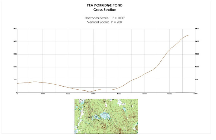
The radar survey will be conducted by dragging Ground Penetrating Radar (GPR) equipment over the Pond's frozen surface along traverse lines located with a Global-Positioning System (GPS) instrument. These traverse lines will cross over the most likely deepest and shallowest parts of the Pond. Figure 1 above (click on it to enlarge) shows their approximate positions on the Pond's surface, based on the depth (bathymetry) map for the Pond published by the NH Fish & Game Department (see diagram on blog's main page below).

We have reason to believe, however, based on conversation with local fishermen, that the distribution of depths on this map may not be truly accurate, and so as we conduct the surveying, we will likely try other traverses until we have certainly located the deepest spot. We will blog-publish a final map when the all the activities associated with the surveying are complete.

Work on the 23rd will start early in the morning (see Social Postings for specific time and location) with the staking of the lines presently shown in the Figure 1 above. Once they are staked, the GPR equipment will be placed on a sled or sleds and slowly dragged by snowmobile along each of the lines. The GPR instrument sends radar signals downward through the ice and into the sediments on the bottom that bounce back and are recorded at varying speeds and intensities by the instruments, which after some computer processing, produce traverse profiles like the one shown in Figure 2a above. These profiles will show the depth to the bedrock or compact glacial deposit that forms the bottom of the basin and then some (hopefully most) of the layering that comprises the softer sediment accumulated within the basin since the glacial ice departed. Then as shown in Figure 2b above, we will use the information on these profiles to locate the 1 or more drilling sites we will use to sample the sediments, probably 2-3 weeks after the surveying is completed (stay tuned to the blog for schedule details).

The field work portion of the surveying will be conducted "snow or shine" and will be completed during the day on the 23rd. Data processing and related interpretive activity will be completed as soon as possible thereafter. You will kept informed via the blog's Scientific Postings.

Meantime, and most importantly, we would not be able to conduct this work and get the MPEP started without the scientific interest and generosity of a number of people and their firms who are donating time and equipment.

The GPR equipment, its field operation, and post-survey analyses are being provided by Hager Geoscience, Inc. of Woburn, MA, courtesy of its President, Dr. Jutta Hager, P.G. and its Vice President of Operations, Mario Carnevale, P.G.

The GPS instrumentation, its field operation, and pre-survey mapping are being provided by North American Reserve, LLC of Laconia, NH, courtesy of its President, Jeffrey Cloutier, P.G., its GPS field instrumentation expert, Michael Wright, P.G., and its CAD Systems Specialist, Shea Ripplinger.

The over-the-snow transportation, equipment sleds and accessories, and related logistical planning and support are being provided by Nordel Gagnon, well-known sage and resident on The Pond.

We'd also like to acknowledge the help and guidance of Dennis Deschane, long-time local fishermen who's search for the deepest spot and the biggest fish may end when this surveying is complete.

Finally, your attention is directed to the Social Postings portion of the blog where information will be provided regarding simultaneous activities on 2/23 that are related to the surveying work and the MPEP in general.

Please note that the next Scientific Posting will be made following completion of the survey's new Pond-bottom map and in advance of the drilling and sampling that will follow, well in advance of ice-out on the Pond.

Saturday, February 9, 2008

Two Kinds of Blog Postings To Come

Very soon, you'll start to see two kinds of postings here on the blog: "Scientific Postings" and "Social Postings".

The first will provide information about the project's on-going scientific investigations (background, methods, schedules, results, reports, etc.).

The second will provide information about meetings and social activities to be scheduled from time to time (generally on or near The Pond) through which you can participate in some of the project's activities and where we can describe and answer questions about the projects' results as they become available.

The first of these kinds of postings will appear in the next day or so. Please feel free to submit questions and/or comments by following the instructions included with each posting.

MPEP will be "up and running" very soon, so stay tuned right here on its blog!