The Madison-Hills Paleoecology Project ("MPEP")

Introduction

The MPEP is a privately funded endeavor that will drill and sample the layers of soft sediment that have accumulated in the deepest part of Big Pea Porridge Pond ("BPPP") in Madison, New Hampshire during the past +/- 14,000 years. The purpose of the work is to scientifically analyze, technically describe/catalogue, and radiocarbon/proxy date these progressively deposited materials to establish the ecologic change-sequence history of the Pond's basin since the departure of the last ice sheet. The work described above will begin in late January or early February 2008 and be completed by late Spring or Summer 2008.

Scientific Basis of the MPEP

Lake-bottom sediments represent the most continuously detailed records of post-glacial (Pleistocene to Holocene) climate and environmental change available, and such records provide the best long term context for the dramatic physical and biological/ecological changes that have occurred during what has become to be known as the "Anthropocene" period (time since the beginning of extensive human habitation).

Who's Involved

The scientific staff of MPEP includes the following individuals, all of whom are donating their professional expertise to the project:

P. Thompson Davis, Ph.D., Dept. of Natural & Applied Sciences, Bentley College.
Brian Fowler, Quaternary Scientist, Project Director.
Lee Pollock, Ph.D., Dept. of Biology, Drew University.
Lisa Doner, Ph.D., Center for the Environmental, Plymouth State University


Monday, December 22, 2008

Scientific Information Posting No. 23

LATEST PROJECT NEWS
First, the MPEP Team has been invited, both formally and informally, to present papers regarding its work to date at the Annual Meeting of the Northeastern Section of the Geological Society of America this coming March in Portland, Maine. These invitations are the result of the scientific interest our project is generating in the post-glacial geologic and paleolimnological communities of the northeastern U.S. and adjacent Canada during the past year. This is an important opportunity for us to present and discuss our current findings with others active in the same scientific fields, and we're excited to be a part of such a process. The abstracts for each presentation can be found by clicking on the following link icon:
Abstracts

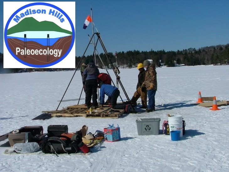
As you already know, we obtained a new basal carbon-14 date for the bottom of the Pond that shows when the influences of the last glacial ice left the basin (~14,000 calendar years ago; see earlier Post). Since that time, we've analyzed the bottom 6 core samples (6 more to go), and have established that while the temperature of the Pond's water varied somewhat from time to time, the organic content of the sediments increased fairly steadily after the Pond was de-iced up to about 9,660 calendar years ago. At that point, something unusual occurred here, and right now we don't know precisely what.
Near the top of core sample T-7, we found two +/- 1 inch-thick light tan to yellow colored bands about 2 inches apart within the otherwise dark greenish brown to black sediment. These were the first such variations we found up to that point in the otherwise consistent sedimentation shown in the cores, and we immediately determined that they must represent some significant change in the environment around the point in time. We initially thought, based on what we estimated the likely rate of sedimentation in the Pond basin to be, that these bands might be the local representation of an important global cooling event that occurred 8,200 calendar years ago. If it did, it would be a very significant finding.
Accordingly, we carefully sampled each band to check their organic content, the relative temperature of the water at the time (from the species of chironomids present in the band's sediment), and their age via a sample for carbon-14 (AMS) dating taken from the regular sediment in the area between the two bands. The date came out at ~ 9,660 calendar years - too old for the bands to be related to the 8,200-year cooling event, but the organic content and the relative temperature of the water both drop significantly within each band. Thus, the bands do represent two significant cooling events of perhaps 100-years each with a break of maybe 150-200 years in between. We've tried to specifically relate the date of these bands with other known climatic cooling events, but have so far been unsuccessful.
Microscopic observation of the contents of the sediment within the bands after all organic material has been removed show they are composed of a combination of millions of siliceous diatom remains intermixed with a generally light-tan to yellow, but in some places orangey and pinkish residue that survived the high heat of the organic removal process with its various colors intact. We don't yet know what this residue is composed of, but we've sent samples out for geochemical analysis. When we get the results and combine them with the pollen analyses that are to begin soon on all the cores, we should be able to determine what these unusual sediments indicate about climate changes in the Pond basin back about 9,600 years ago.
We, of course, will keep you posted here on the blog in the next few weeks. Meantime, if you have comments or questions, please contact us by commenting here on the blog (instruction for doing so on the homepage). So far, very few folks have chosen to comment, but please do. It's easy, and it will be great to hear what you think the bands may represent about our Pond "back in "The 96-Hundreds".

Wednesday, October 8, 2008

Scientific Posting #22

The Chironomids

Among the sources of evidence of past climate conditions that lie buried in the layered sediments of lake bottoms are the remains of midge larvae. Today, non-biting midges (of the insect order Diptera, family Chironomidae) are abundant almost everywhere. You may have encountered tiny adult midges lying dead beneath the nightlight in the bathroom in the morning. They lay eggs in water and their larvae go through a series of molts before they metamorphose into pupae and ultimately into flying adults. The larvae (1/16th to 1/8th inch or so in length) are cumulatively so abundant that they typically form the largest single source of animal biomass in lake-bottom sediments. As such, they contribute an important food chain link between the detrital organic matter and algae that they eat and larger benthic (i.e., bottom dwelling) invertebrates or bottom-feeding fishes.
Because of their ecological importance, this group of insects has been well studied with regard to their identity (>5000 species worldwide so far), their distribution and the conditions required for their well-being. As arthropods, their construction includes a non-living exoskeleton covering that remains more or less intact long after the decomposable organic parts of the animal are lost over time. The head capsule of these animals are particularly thick and resilient and can be found identifiably preserved in the sediments into which they settled even thousands of years ago. Features of their heads – especially the appearance of their teeth, their dentition – are used by biologists to identify them at least to the genus level.
To study the chironomids present in the distant past, 3 cubic centimeter subsamples of sediment are removed from various levels within a sediment core. Each sample is immersed in hot 5% potassium hydroxide solution for 20 minutes, which disaggregates clumped sediment particles. The resulting mixture is passed through sieves with mesh sizes of 118 μm (micrometers) and 53 μm and rinsed with distilled water. Particles larger than 118 μm and 53 μm respectively, including the head capsules of chironomids, are retained in the sieves, while the bulk of the material, including most of the disaggregated sediment particles, pass through the 53 μm mesh. The material caught by each sieve is back-washed into a Petri dish and examined using 40X power of a dissecting microscope (see Figure 1).

Figure 1

Watch-makers forceps are used to transfer each head capsule present within the resulting debris to a drop of CMC-10 mounting medium on glass slides. A coverslip is added and the slide is observed using 100-430X power of a phase contrast compound microscope. Identifications are made with reference to several helpful publications (especially, Brooks, SJ, Langdon, PG, and Heiri, O. The Identification and Use of Palaearctic Chironomidae Larvae in Palaeoecology. Quaternary Research Association Technical Guide No. 10. 2007). A minimum of 50 chironomid heads must be located and identified to provide sufficient data to characterize the community of these animals found at a particular depth (= age) within a sediment core. It requires 3-5 hours of painstaking work to complete the analysis of each subsample.
The composition of the chironomid community that settles into surface bottom sediments today would be very different from that found towards the deepest segments of our core sample. The climatic conditions that favor today's community are presumably quite different (e.g., much warmer) than conditions here would have been 10,000 years ago. While many of the chironomid types found in the deepest parts of our core are no longer found locally, they do occur alive and well in today's cold climate areas such as Baffin Island or Labrador or in high elevation alpine tarns. Biologists studying these high latitude or elevation types have been able to determine the environmental conditions that these living representatives require. Distribution of chironomids is particularly highly correlated with mid-summer, surface-water temperatures of the lakes where they are found. We assume that the same critters living here years ago had similar requirements to their currently living representatives that over time followed the cold water conditions they prefer polewardly as the glaciers retreated and the climate here warmed. Species that have narrow preferences for cold water conditions are especially useful as indicator species, i.e., their presence in the past suggests that this narrow range of cold conditions existed then. Such species are referred to as stenothermal (steno – (Greek) narrow + thermal – (Greek) temperature) and they can be used as "proxy" clues to reveal temperature conditions wherever or whenever they are found.
Predictive models have been constructed based on documented requirements of each of these stenothermal species. Each species' optimal mid-summer, surface-water temperature requirement contributes in proportion to that species' abundance within a chironomid community from the past (i.e., from a particular sediment level) to produce a best-guess inferred mid-summer, surface-water temperature present at the time when that layer of sediment settled out.

Figure 2

(For example, Heterotrissocladius, shown in Figure 2, has an optimal temperature of 11.1 C, while Sergentia, shown in Figure 3, is optimal at 9.8 C). Doing this repeatedly at intervals through the sediment core permits the reconstruction of the most-likely temperature history of the pond over time.

Figure 3

We extracted a first-round of 15 sediment samples at 20 cm intervals from the deepest part of our core. Preliminary results demonstrate that we need to add intervening samples, resulting in 10 cm intervals, to improve the resolution of our model-generated temperature curve. We intend to gather these additional samples (and more) when we return to the core sampling on October 25th. It will be some time before the more refined results will be available. For now, we can say that in comparison to the mid-summer, surface-water temperature of 24.5 C (76 F) at Big Pea Porridge Pond in 2008 (see Scientific Posting # 20), comparable model-generated temperatures from the earliest portions of our core are, appropriately, in the 12-18 C (53.5-64.5 F) range.

Lee Pollock

Monday, October 6, 2008

Scientific Posting #21

Follow-up Plankton Tow in Big Pea Porridge Pond, August 26, 2008

To explore the composition of the plankton community responsible for the "positive heterograde" dissolved oxygen curve (see Scientific Posting No. 20), a 10 minute plankton tow was taken along a mid-lake transect with the net weighted to tow at a depth of ca 10 feet. Here is an annotated listing of some members of the plankton community at Big Pea Porridge Pond in Madison, NH, August, 2008

PHYTOPLANKTON = the microscopic, unicellular or colonial PLANT (or in one case bacterial) component of the plankton community.

Division: Cyanobacteria – blue-green bacteria
Anabaena : Chain of beads, including an occasional, larger "bead" known as a heterocyst. This is the site of nitrogen-fixation. This genus can become overly productive blooms and cause water quality problems. The neat thing about Anabaena in Big PPP is that it was not at all abundant. However, it formed some tiny ball-like masses to which a form of stalked ciliate protozoa, Vorticella-like, was attached. The beating of the cilia to create feeding currents by the Vorticella also propelled the entire colony around through the water – presumably an asset to Anabaena by bringing it to fresh nutrients and reducing its sinking rate in the water column.

Division: Crysophyta – golden-brown algae
Dinobryon: Colonial. Vase-shaped case or lorica, each with two flagella to provide some mobility to the colony. When abundant, Dinobryon sertularia gives a fishy taste to the water.

Diatoma: Colonial diatom.

Division: Chlorophyta – green algae
Asterionella – star shaped colonies. Individuals are glued to one another at one end by mucilage.

Micractinium – small spherical cells with projecting spines to aid with floatation.


Division: Pyrrhophyta – dinoflagellates
Ceratium – armor plated cell with 3 long projecting spines that assist in floatation. They are "mixotrophic", i.e., they both photosynthesize like a plant and phagocytize, eating other organisms, like an animal.

ZOOPLANKTON = the microscopic, unicellular ANIMAL component of the plankton community.

Phylum: Rotifera
Asplanchna – large sac-like rotifer. Feeds on algae and bacteria. Its presence here suggests productivity is more towards the oligotrophic side. It also suggests that pH of Big PPP is usually at or above 7 (neutrality).

Keratella feed on algae and microorganisms. They tend to have two population maxima – one in the spring and a second in the summer. They live for about 3 weeks – longer than many rotifers whose lifespan in measured in days. They tend to be associated with oligotrophic waters.

Kellicotia longispina – with 4 long spines that assist with buoyancy – slowing its sinking rate. They are typically in oligotrophic waters and have a single mid-summer population maximum.

Phylum: Arthropoda Subphylum: Crustacea Class: Malacostraca
Order: Cladocera ("water fleas")
There are illustrations and descriptions of each of these water flea species at: http://ilmbwww.gov.bc.ca/risc/pubs/aquatic/crustacea/

Bosmina longirostrus A small, substrate-dwelling type with antennae modified to form an "elephant trunk"-like projection. The remains of exoskeletons of this type of water flea are the most common objects of animal origin found in our deep core samples from the past.

Daphnia longiremis Their egg cases or ephippia are among the items that remain well preserved in the sediments thousands of years old in our core samples. An indicator species for cold, oligotrophic waters.

Holopedium – has an inflated body covering encased in a large gelatinous coating. Uniquely among water fleas, it swims ventral side up. It tends to be associated with lakes tending toward the acid side of the pH scale, so it's presence in Big PPP clashes a bit with the rotifer Asplanchna. An indicator species for cold, oligotrophic waters.

Leptodora – a large (up to 18 mm) and bizarre water flea with enlarged, wing-like second antennae and legs adapted for capturing rotifers and other plankton.

Phylum: Arthropoda Subphylum: Crustacea Class: Malacostraca
Order: Copepoda

Cyclopoid copepods: club-shaped body with curved antennae or moderate length. Some are predatory, others are grazers. Undoubtedly several species.

Calanoid copepods: torpedo-shaped body with long straight antennae. Algal filter-feeders. At least two species – including one bearing conspicuous orange droplets of oil-storage reserved. This species is often associated with acidified waters.

Nauplius larva: only three-pairs of appendages. Undergo six growth stages or moults. Life cycle lasts 5-6 months.

As a rough indication of the relative abundance of these members of the plankton community at Big Pea Porridge Pond in late August, 2008, the following lists numbers observed in a 5 cc sample from a 10 minute plankton tow at 10 foot depth.

Phytoplankton (# of colonies)
300 Dinobryon slender
10 Dinobryon sertularia
600 Micractinium
60 Asterionella
80 Diatoma
10 Ceratium (individuals)
2 Anabaena
Rotifera
1 Dichoerca
24 Keratella
2 Asplanchna
4 Kellicottia
Cladocera
1 Leptodora kindtii
8 Holopedium gibberum
19 Diaphanosoma brachyurum
4 Daphnia pulcaria?
3 Bosmina longirostrus
17 Ceriodaphnia reticulata
Copepoda
61 Calanoid copepods
49 Cyclopoid copepods

(Click on the image below to be linked to a slideshow of more images of community members)
From Scientific Posting #21


Lee Pollock

Monday, September 29, 2008

NEWS

LATEST NEWS

Now that the summer's activities and travels, along with two weddings(!), are out of the way, work is scheduled to restart on the project. The splitting, sampling, and logging of the remaining core samples is scheduled to be completed over the weekend of October 25-26, and thereafter, the remaining laboratory work (C-14, pollen analyses, Loss-On-Ignition, magnetic susceptibility, etc.) will be completed as soon as practical by the various labs services. Meantime, scheduling discussions will begin soon for the completion of the pond bottom-surface ground penetrating radar survey (GPR) that had to be postponed last winter because of slushy ice surface conditions on the pond.

So, as all this gets retarted, the blog will begin to become more active as this Autumn and Winter progress. For now, sorry for the long silence. We didn't quit the project - just had lots of professional and family obligations.

Tuesday, August 26, 2008

Scientific Posting #20

Mid-Summer Temperature-DO Profiles

Earlier, we posted results from winter and spring water column surveys of temperature and dissolved oxygen (a posting from April 4, 2008 and Scientific Posting Numbers 15 respectively). Accompanying those results are discussions of how this information can help us understand the circulation and productivity of Big Pea Porridge Pond.

This posting continues the sequence by adding temperature and oxygen profiles from summer (August 3, 2008), when the temperature stratification or layering of the water column is maximal. The warmed top layer or epilimnion of the lake shows temperature in the 23-25 C range (73.4-77 F) extending some 4 meters (13 ft) into the water column. The deep waters of the lake, i.e., the hypolimnion waters, are in the 7-8 C (44.5-46.5 F) range. The intervening zone, from 4-8 meters depth, in which the temperature falls by at least 1 degree/meter, is the metalimnion or thermocline.

Larger, "first class" lakes hold all of the summer-added heat in surface waters, leaving the deep hypolimnion waters constant at 4 C (39.2 F) year-round. The hypolimnion depths in smaller lakes like Big Pea Porridge Pond incorporate some "excess" surface heat defining our lake as a "second class" lake (an unfortunate term with ABSOLUTELY NO bearing on its importance to us!).

Oxygen enters freshwater lakes in one of three ways: imported -- via diffusion from the surrounding atmosphere or as dissolved oxygen in inlet streams, or in-situ -- as a by-product of photosynthesis (6 CO2 + 6 H20 → C6H12O6 (glucose) + 6 O2). The August 4th oxygen profile (circles) provides interesting results. A curve of this sort, with the oxygen maximum in the metalimnion (thermocline) is known as a "positive heterograde oxygen curve". Large, cold water inlet streams could theoretically bring higher levels of oxygen in as a colder, denser water mass at such depths. But there are no such inlet streams entering Big Pea Porridge Pond. The only other logical source for high levels of oxygen 6 meters down in the metalimnion would be productivity by single-celled or colonial phytoplankton located there. Because high light levels (including damaging UV light) found in surface waters are actually inhibitory to most phytoplankton, maximal photosynthetic activity by phytoplankton is usually found somewhat deeper. But a deep positive heterograde peak like that seen here in early August results from dominance by cold-adapted phytoplankton that do best in waters away from the sun-heated epilimnion. Often less-desirable blue-green photosynthetic bacteria such as the filamentous Oscillatoria are responsible for such curves. (Blue-greens are less desirable because they tend to produce chemical byproducts that other organisms find toxic). We need to follow up with a deep plankton tow to determine what phytoplankters are found at depth here in our pond.

Observed dissolved oxygen readings can be compared to the line in the figure with triangle symbols that represents what would have been saturation levels of dissolved oxygen based on the actual temperature reading alone (recall the inverse relationship between temperature and the solubility of all gases -- meaning that the higher the temperature, the less dissolved oxygen would be available). The supersaturation levels within the metalimnion are clear. But also note that observed dissolved oxygen falls short of saturation levels toward the bottom. Typically, loss of dissolved oxygen in deep waters results from oxygen consumption by the bacterial and fungal decomposers found in bottom sediments. The degree of their activity, and thus the degree of oxygen consumption through their respiration, is a reflection of the amount of organic (biologically produced) matter available. Little productivity (oligotrophy) would result in little decomposer activity and little oxygen depletion below saturation levels. High productivity (eutrophy) would provide enough organic fall-out to fuel extensive decomposer action and a steep depletion of deep oxygen perhaps even to producing anaerobic (oxygen-free) conditions. Our situation matches what we observed in our March profiles – about one half the available oxygen has been consumed, suggesting a mesotrophic condition in Big Pea Porridge Pond. .. Lee

Wednesday, August 6, 2008

Scientific Information Posting No. 19

NOTICE
UPCOMING PROJECT INFORMATION PROGRAMS
There are 2 informational programs concerning the project scheduled in the next several days for those interested who want to get caught up on latest research developments and plans.
The first is a slide and video illustrated presentation at 7:00 PM, on Thursday, August 7th, at the Tin Mountain Conservation Center's Headquarters, on Bald Hill Road, in Albany, NH. Specific program details can be obtained by contacting the TMCC at 447-6991.
The second is an informal "Display and Q & A Session" to be held in conjunction with the Green Mountain Conservation Group's Annual Celebratory Evening & Fundraising Dinner, beginning at 4:30 PM, on Saturday, August 9th, at the Province Lake Golf Club, in Parsonfield, Maine. Event information can be obtained by contacting the GMCG at 539-1859.
We look forward to seeing you.

Sunday, July 20, 2008

Scientific Information Posting No. 18

LARGER PHOTOGRAPHS AVAILABLE

Several folks have asked if there are larger versions of the photographs included in Scientific Post No. 17 available(?). Yes, there are.

Bob Christiansen emplaced a link near the bottom of Post No. 17 which, if you click on it as instructed, will lead you to a selection of enlarged images for easier viewing.

Monday, July 14, 2008

Scientific Information Posting No. 17

Splitting the Cores

Sorry to offer this posting a little out of order. With all the flurry of follow-up investigation of material sampled from the core, we neglected to offer a glimpse of the core splitting session itself.

A group of us met at Plymouth State University on Saturday, May 3 to begin the process. To start with, we retrieved the deeper core segments from the 4 C coldroom where they had been stored since the original sampling date. The foil and cling wrap covering of the core segment was carefully unwrapped and details regarding its appearance and texture were noted.


Then the segment was split longitudinally into halves to reveal the interior material.
Having laid a tape measure along side it, we photo-documented the segment and, using a standard soil color chart, we noted its appearance before subtle color tones could change as these sediments were exposed to air for the first time in thousands of years.


Most core segments (such as the one below) have a brownish-gray appearance produced by the remains of biologically produced organic materials (plant, animal, and microorganismal remains) mixed with inorganic mineral materials. Brownish organic deposits in lake bottoms is known as "gyttja" (a Swedish word, pronounced "yit-yah").


Then at specific depth intervals along the core, subsamples of sediment were extracted for detailed analysis. All subsamples were removed from one side of the split core so that the opposite side could be stored intact for archival purposes. Subsamples taken


will be examined for the remains of midge larvae (or chironomids – useful in reconstructing past temperatures), pollen (useful in reconstructing a picture of changes in the surrounding landscape), the degree of sediment compaction (useful in analyzing the impact of overlying geological forces) and organic content (using a "loss on ignition" or LOI technique – useful in characterizing changes in overall biological productivity over time). The significance of each of these studies will be presented as results become available in the months ahead.

As we had seen in the field, in the 11th segment we collected, a dramatic change in appearance was noted between the brownish (gyttja) sediments and the gray mineral silts that apparently lack such organics. The illustration below shows that transition point between 23 and 24 meters below the Pond surface. A subsample of sediment from this transition point was used for dating purposes (described in Scientific Posting 16).


Click on this image for short slideshow of larger images!


Lee Pollock

Tuesday, June 10, 2008

WHERE ARE THE PICTURES?

Several people have recently asked where/how to find the pictures and slide show taken during the actual drilling out on the ice last March. It's easy.

Simply scroll all the way down to the last the postings on the blog as it exists today and then click on "Older Postings" in the lower right-hand corner. Once you're into these older postings, scroll down until you reach the post that includes the photos/slide show.

Sunday, June 8, 2008

Scientific Information Posting No. 16

WHEN DID THE GLACIER LEAVE THE BIG PEA PORRIDGE POND BASIN?

Well folks, sorry for the long delay in getting information to you here on the blog. Since we finished the first round of sample splitting and sampling in early May, we've been awaiting laboratory results to report and to use to plan the next steps in our investigation. Now, the first of these results is "in", and here it is - the one you've all been waiting for.

The Carbon-14 (AMS) age of the likely oldest organic material at the bottom of the Pond is 12,150 +/- 50 years. If you correct this to calender years, it lies between 13,910 and 14,100 years, or just about 14,000 years.

This is the age of the first organic material to be deposited on the surface of the very compact silt and clay basin left by the glacier when it departed, and it represents the starting date for the rest of the paleoecological history of the Pond our investigation will gradually reveal over the coming months. This date represents the point in time when the local climate had warmed sufficiently from very cold glacial conditions so that the first types of pond vegetation and critters could sustain themselves in and around the Pond. Our investigation from here will document just what these life forms were and how they changed over time to the present. Suffice to say for now, though, you can rely on the fact that we are all part of a history here on the Pond that started 14,000 years ago.

Bear in mind that this date is just the first in what we expect will be a long line of such information (along with more professional analyses) that will come out of our investigations over the next several months. Please feel free to send us your comments and questions via the Commenting Feature here on the blog. We'd enjoy the chance to talk with you about these exciting developments.

Also, keep on eye here for "social postings" about the one or more of information meetings we hope to conduct this summer on the Pond to describe what we're finding and discuss what it all means about the paleoclimate and past ecology of the Pond's basin. As things proceed along with our work and we learn more and more about what went on here in the past 14,000 years, "the Pond will never be the same" to any of us.

More later and as it becomes available...

Friday, May 9, 2008

Scientific Information Posting No. 15

Follow-up DO-Temperature Profile

Earlier, we posted a temperature-dissolved oxygen profile for Big Pea Porridge Pond taken March 30, 2008. Its purpose was to show:

1) the winter temperature profile, with densest (4 C) water filling the lake bottom and underlying colder (therefore less dense) water beneath the ice-covered surface. With less dense water "capping off" more dense deep water, the water column is stabilized, i.e., little vertical mixing or replenishment of deep waters occurs in winter. Also, ice cover prevents wind (the major force behind lake water mixing) from accessing the water surface. Winter stagnation of the column results.

2) the dissolved oxygen curve dropping off with depth. Loss of oxygen in deeper waters is primarily the result of the bacterial/fungal decomposition of organic (i.e., biologically derived) matter that has sunk to accumulate on the bottom. Without circulation to replenish lost oxygen, the extent of oxygen loss is a rough measure of how much organic matter is produced in the lake – in other words, its level of productivity.

As warmth returns in spring and the ice melts, the < 4 C surface waters heat up to match the 4 C deep waters. At that point, temperatures and therefore density of waters within the entire water column are equal. As a result, the water column loses its "stability". As the wind blows across surface waters, pushing them toward the leeward side of the lake, surface waters are driven downward, while elsewhere in matching volume, the lake deep waters are forced to the surface. This creates a "turnover" during which the water column becomes uniformly mixed. Temperatures and dissolved oxygen levels (replenished as oxygen-stripped deeper waters mix to the surface and make atmospheric contact) are equal top to bottom.

This process is the "spring turnover". Full lake vertical mixing like this returns to sun-lit surface waters the nutrients that were freed during the winter as decomposers worked over the organic matter there. These vital nutrients were trapped until the turnover by the stagnant winter water column. With sunlight and nutrients finally available in surface waters, the single-celled and colonial phytoplankton (the plant component of the plankton community – algae, diatoms, dinoflagellates, bluegreen bacteria, etc.) – can surge into photosynthetic action, producing a peak in lake's annual productivity known as the "spring bloom".

The graph below shows the temperature-dissolved oxygen profile observed on May 9, 2008 at the "deep spot" in Big Pea Porridge Pond. If you tip your head 90 degrees to the left, you can see the results from top (left) to bottom. As you will see, we missed catching the turn-over period exactly. While the water column is still pretty uniform with regard to dissolved oxygen levels, the temperature profile is no longer uniform. Understandably, the top 3 meters of surface waters are capturing more heat than deeper waters. By doing that, the warming surface waters, referred to as the "epilimnion", are also becoming progressive less dense than the deeper, cold waters of the "hypolimnion". (There is an inverse relationship between temperature and density – the higher the temperature, the lower the density of water). The intermediate zone including the steep temperature gradient separating these two layers, e.g., between 2-3 meters on this graph, forms the "metalimnion" or "thermocline". As the temperature-density contrast builds between epilimnion and hypolimnion waters, the stability of the water column builds. Deeper, colder, denser waters resist wind-driven vertical mixing of warmed surface waters. The whole lake is no longer involved in mixing – just the wind-driven, warmer epilimnion waters continue to circulate. As the vertical depth of mixing becomes more limited, lower-density, surface epilimnion waters become warmer and warmer, and the stability of the water column increases. This leads to a summer-time stratification/stagnation of the water column that isolates deep, darker, colder hypolimnion from the sunny, warm low density epilimnion. The buildup of the summer temperature stratification will be the subject of our next temperature-dissolved oxygen profile later on in the season.


Lee

Wednesday, April 23, 2008

Scientific Information Posting No. 14

While not purely scientific information, this is a project follow-up note on aesthetics for residents of Big Pea Porridge Pond looking out across the melting but still nearly complete ice cover (here on April 23!). We just wanted you to know that the debris the melting ice is revealing in the general vicinity of the drilling site is NOT anything we left behind there! But it is indicative of the depth of ice & snow cover this winter that the bright red plastic milk crate and the several large blocks of wood revealed now were completely and invisibly buried there at the time of our drilling operation. Lee.

Wednesday, April 16, 2008

Quick update on scheduled presentations regarding the MPEP project

1. We will be included with a poster/information table display at the Climate Change Forum scheduled for 6:30-8:30 p.m. on Monday, April 28th at the Kennett High School Auditorium. At the forum, presentations from experts around the country will focus on the science as well as economic and social aspects of the climate change phenomenon, including regional and global challenges and solutions. Speakers from organizations and state agencies will provide presentations on New Hampshire’s Climate Change Action Plan, information and science related to their field of expertise, and will also answer audience questions. Call 539-1859 for more information. Hosted by the Green Mountain Conservation Group, Eagle Academy and Timberland, Inc. The public and other schools are welcome to attend this event.

2. We will also use the poster/ information table format to help represent the activities of the Tin Mountain Conservation Center at a gathering from 6:30-8:30 at Granite State College on Wednesday, May 21. We have recently formed a linkage to Tin Mountain, finding that the MPEP project has much in common with their educational mission.

3. We will present a program based on the MPEP study for the Kennett High School Environmental Club at their monthly meeting at the Tin Mountain Conservation Center on Wednesday, May 21. Contact Tin Mtn for more information: 447-6991.

4. On Tuesday, June 10, we will review the MPEP program so far, and talk about its goals as part of the Tin Mountain Conservation Center's Nature Program series. More information at Tin Mtn: 447-6991.

At each of these sessions, we hope to gather names of individuals interested in the issues raised by our project. This group will form an informal discussion "club" that will be invited to meet at the Tin Mountain Center periodically to learn about new information as analytic results become available and to help us all explore the evolving story of the post-glacial period in this area.

Lee Pollock

Tuesday, April 15, 2008

Scientific Information Posting No. 13

QUICK NEWS UPDATE

It's been relatively quiet on the MPEP front since we completed the drilling and sampling in early March, but things are beginning to percolate once again.

First, the project staff has now scheduled the so-called "Splitting and Sampling Party" for Saturday, May 3rd. This "party" will take place in the paleolimnology lab facilities at Plymouth State University with Dr. Lisa Doner as our gracious host. This activity will establish the next stage of the project's work tasks, primarily those that involve careful laboratory testing and documentation.

There are several specfic purposes of this activity once our samples have been retrieved from the walk-in storage cooler (maintained at 4 degrees Celcius since the field samlping) at PSU:

(a) to carefully split the samples longitudinally so we can inspect their interior where the shearing effects of the drilling and sampling process will not have disturbed them;

(b) to photograph and carefully document the nature, texture, and sedimentary structure we see on these freshly-exposed surfaces; and,

(c) to determine what type and how many specific laboratory test samples to take from these surfaces to develop the best picture of the samples' ages and fossil organic components.

This latter step will probably require the longest portion of this rather "full day" at PSU. We will report to you all asap after the work is done as to what was found and what testing is proposed to be done. That report will include the best photographs of the day, descriptions of the more interesting structural findings from within the samples, and preliminary comments on the possible paleoclimate history we begin to see. We will also attempt to establish a schedule for the lab results to "come in" and when we might be able to formulate a better picture of the Pond's paleoclimatic history, likely sometime in the mid to late Summer this year.

The second item of news is that Thom Davis and Brian Fowler have been asked to present papers as part of a northern New England pond paleolimnology theme session at the annual meeting of the Northeast Section of the Geological Society of America next Spring. Word of our project "has gotten out" in the regional geological community, and people are interested in what we've done, how we've done it, and what results we may have obtained by the time of the meeting. Abstracts for these presentations will be available nationally through the Society, so word of MPEP will spread. We'll also post them here on the blog. More about this later...

So for now, things are moving more slowly but surely. We will be back in touch in several weeks with more exciting news. Please stay tuned, and please give us your comments and questions here on the blog. For those not familiar with its use, please refer back several Scientific Posts to the one that provides the simple instructions. We'd love to hear from you all!

Friday, April 4, 2008

Amount of Organic Sediments Accumulated….Reconsidered.

Thinking about a full meter of sediments settling in a millennium seems like a lot of material to accumulate. On the other hand, when you recalculate that same meter of sediments on an annual basis, 1 meter or 1000 millimeters in 1000 years, the accumulate rate is only 1 mm per year, and that seems much more plausible. This would be especially so when you consider concentrating particulate materials appearing throughout the lake's interior in the lake's deepest area (much like gently swirling a coffee cup accumulates the grounds in the bottom center).

The accumulation rate of organic materials also depends on how productive the lake is – especially the contribution by the photosynthetic members of the microscopic plankton community (i.e., the "phytoplankton" – such as algae, diatoms, or blue-green bacteria). The VLAP data for Big PPP suggests chlorophyll-a concentrations are low enough to qualify the lake as oligotrophic (see other blog posts for a discussion of both VLAP and the oligotrophic/eutrophic questions), although the levels of cholorophyll-a and total phosphorus in surface waters of the lake show a historical trend of increase. More on that during the next year since the VLAP promises a report for the lake that will include a more extensive analysis of changes they have observed in more than 10 years of sampling data.

Meantime, another way to gain a "snapshot" view of the amount of organic matter produced within a lake (often primarily the result of phytoplankton productivity), is to observe a temperature-dissolved oxygen profile through the water column, taken when there is minimal circulation of the lake's waters. There are two times of year when this condition is met. Toward mid- to late-summer, when surface waters heat up more than deeper waters (your body is warm but your feet are cold when floating upright in the water), very little mixing of the water column occurs and deep waters stagnate. Also during the winter, when surface waters are colder than deeper waters (because freshwater at about 4 C is densest and sinks to occupy deeper parts of the lake – so water both less than AND more than 4 C are less dense and sit above 4 C water) and ice prevents wind from causing water movement and circulation, again the deep waters stagnate. In either case, without circulation, oxygen in deep waters can not be replenished from the surface, so if oxygen is consumed down there, the concentration of oxygen dissolved in the surrounding deep water declines. (Oxygen replenishment to the depths occurs primarily during spring and fall period of "turnover", when the whole water column is similar in temperature and thus equal in density, and the resistance to vertical mixing is minimal).

Some deep water oxygen is lost to various chemical reactions in bottom sediments. But the major source of oxygen depletion is from fueling the biological activities of the decomposer community – the bacteria, protists, fungi, etc. that live on and in bottom sediments and use the fall-out of organic particles (plant or animal parts, undigested wastes, biological detritus rinsed in from the surrounding landscape, etc.) as their food – their energy source. Like the rest of us "consumers", most of these decomposers use aerobic (oxygen-consuming) biochemical breakdown pathways, so to the degree that decomposition is going on, oxygen is lost from stagnant deep waters – and what is lost is not replenished until the next turn-over period.

Strictly "oligotrophic" lakes, with few nutrients and very limited phytoplankton productivity as a result, produce very little organic fall-out for the bottom-dwelling decomposers to use. As a result, not much oxygen is consumed in deep waters – even during periods of water column stagnation. Conversely, "eutrophic" lakes, loaded with nutrients and supporting dense phytoplankton growth, produce lots of organic fall-out, offering an on-going feast to the decomposers, who oblige by stripping the deep waters of their oxygen content. Comparing the actual levels of dissolved oxygen present throughout the water column with the maximal amount of dissolved oxygen possible, given the water temperature and no sources of consumption (i.e., the "saturation" level of dissolved oxygen), gives you a valuable piece of evidence about how much decomposition, and thus how much productivity, has occurred in a given lake. Little departure from saturation levels – ultra-oligotrophic, very low productivity lake. Oxygen levels falling to very low levels or perhaps to zero (= anaerobic conditions) – strongly eutrophic, very productive lake.

On Sunday, March 30, 2008, I performed such a temperature-dissolved oxygen profile on Big PPP. Since it's later in the season, I worked my way cautiously out toward the drilling site – stopping 4 times to auger my way through the snow & ice cover to be sure I was safe. In each case, there was 32-34" of consolidated, frozen snow & underlying ice present – including 10" of pretty solid ice at the base. In no case did I even begin to penetrate through the overlying consolidated snow layers, and knowing there was 10" of ice beneath, I felt okay proceeding. (Thanks to Bob Denoncourt for sharing his DO meter for this).


The graph below shows the results of this survey. You'll need to tip your head 90 degrees to the left to see the graph with data lines proceeding from the surface to the deepest spot at this particular site – about 33 ft. The temperature line (square-symbol line) is to the left and shows the less than 4 deg C (i.e., less dense waters) sitting on top of the 4 C layer toward the bottom. (If it weren't for this so-called "density anomaly" of water – being densest at 4 C (cold, but above freezing) – freshwater bodies would freeze top to bottom, and probably do in most of the creatures therein in the process). The actual dissolved oxygen curve (circle-symbol line) ranges from about 15 mg/L near the surface down to ca 5.7 mg/L at the bottom. The triangle-symbol line to the right shows what saturation dissolved oxygen levels (based solely on temperatures) would look like at each depth.

Clearly, the observed DO line doesn't closely follow the saturation curve, so we aren't as oligotrophic as would be possible. But it doesn't fall off to really low numbers or zero at the bottom, so we aren't strongly eutrophic. Using this one estimate of productivity, we might surmise that Big PPP is somewhere in between – tending toward the oligotrophic side of being "mesotrophic", since the 50% loss of saturation oxygen we see still leaves a fair bit of dissolved oxygen in the deep water to stimulate decomposition. But this does suggest to us that there is fair phytoplankton productivity in the surface waters, and that surely phytoplankton joined by zooplankton (the animal members of the plankton community) remains will have made a significant contribution to the buildup of organic-rich sediments at least in recent years.

.. Lee Pollock

Saturday, March 22, 2008

Blog-meister does it tough!

Spare a thought as your fearless Madison Hills Paleoecology project blog-meister (wearing the appropriate protective gear) battles significant environmental hardship (distraction?) down-under to update the blog with the latest scientific data (and ruminations) just in from the arctic tundra field team on BPPP - fourteen times zones and two seasons away!

Friday, March 21, 2008

Social Posting #7

With the success of our latest drilling day behind us I want to extend a heartfelt thank you to those who helped before, during and after the project on the behind-the-scenes activities. Firstly, and very importantly, a huge thanks go to Lee and Sylvia Pollock for their enthusiasm, encouragement, and support in so many ways I can't begin to describe. One way was in allowing us to use their house for the initial January introductory meeting where so many of you came to find out what this was all about. They have supplied food and drink for that first meeting and countless other informal meetings about the project. They put their heads together with us and came up with the "patch" design and it's name. And, they've been a constant source of project energy and creativity-intellectual, physical and psychological. I'm not sure we could have pulled this off without them.

Wednesday, March 19, 2008

Latest Coreing Photos (with descriptions)!!

Click on the link below for photos from both coreing days. This time they are in chronological order and have annotations - thanks to Betsy!


Now that the field work, the really "tough stuff", is finished, I'd like to thank the folks that were so patient with all the logistical and weather-related schedule changes and who worked so hard on the two field days to make the "on the ice" portion of the project a success. Starting at the top and going left-to-right in rows (or top to bottom on the blog), they are:
Dr. Thom Davis & Dr. Lisa Doner: Thanks for furnishing the 2 & 3-inch samplers and related equipment, invaluable drilling and sampling advice, drilling & sampling production consultation, and psychological counseling at several of the project's more discouraging moments. We are very fortunate to have your professional skill and research expertise on our comparatively small research project.
Russ Lanoie & Betsy Fowler: Thanks to Russ for mercifully and resourcefully helping us recover from, and then avoid, the first day's back-breaking work by (a) creatively designing and cleverly fabricating (on very short notice and on a weekend to boot...) the tripod-mounted, come-along sampler retrieval (lifting) system we used to complete the project and (b) by furnishing his Yanmar tractor and trailer for load hauling to and from the project's beachheads. I doubt we'd have completed the second day's work or the field part of the project without this incredibly valuable assistance. We all owe Russ (and Joan) several steak dinners.
Thanks also to Betsy who "held the fort" at the beachhead during both days of field work and who made very creative and timely arrangements for food, drink, and medical supplies out on the ice. She also deserves much credit for keeping the Project Director in-line and properly focused on positive outcomes, despite the seemingly relentless interference of the weather and various logistical complications. She deserves, and will soon receive, a broiled salmon dinner.
Beth Gagnon & Noreen Downs: Thanks to Beth and Noreen for their expertise and patience in making two video records of the project work in the field. Both endured cold windy days of standing about waiting for something to happen in between drilling thrusts and pulls. They also endured some salty language and "project oaths" from those working the platform, but always responded as though they hadn't heard anything and by encouraging us to push ahead, several times offering helpful suggestions of how to do things that had escaped the rest of us. They both intend "to make something more" of the video material they collected, so stay tuned.
Dave Downs & Pete Howland (unfortunately no picture...somehow he slinked away): Thanks to Dave and Pete for working the platform with us on the first and second days. Their practical minds, quiet suggestions, and substantial physical statures were of enormous help in getting both day's work completed. They were always thinking ahead of the operation and were ready with the proper tool or body position on the platform to be just the right help at just the right moment. These guys also deserve steak dinners; arrangements are underway.
Dr. Lee Pollock: And finally, but not least, a special thanks to Lee. Without his energy, enthusiasm, and careful oversight of so many facets of the project's planning and execution, and especially its measurement and documentation along with the general well-being of the Project Director, we would not have completed things as efficiently and thoroughly as we did. Lee was the project's "energy source" for all of its facets, and I am very grateful for his patience, resourcefulness, and encouragement.
So, thanks again to everyone. I am deeply indebted to all. Now, we're on to the next phases of the work.

Tuesday, March 18, 2008

Scientific Information Posting No. 12

SUCCESS!

Here's a "quick post" to bring you all up to date with the basic results of yesterday's continuation of the drilling and sampling. We completed our quest for the bottom of the Pond's basin with the aid of Russ Lanoie's expertly designed and fabricated tripod/come-along retrieval system, his small Yanmar tractor and trailer, and the able assistance of the project's staff and several volunteers. I will be posting another "Thank You" in the next day or so to recognize each of these folks and their specific contributions. But for now, many thanks to everyone!!

We were able to reach a total and final depth of approximately 33 feet beneath the Pond's bottom or approximately 79 feet beneath the water surface of the Pond. These depths will be more specifically defined after we reduce the field data taken during the driving and retrieval process for each sample. Meantime, the precise GPS information for the hole location is: Latitude 43-56-29.7678; Longitude 71-07-5.2484; and elevation 647 feet above sea level.

Sample recovery from the two days of work (3/11 & 3/17) includes approximately 30 feet of greenish brown to dark brown, lightly to moderately compacted gyttja (organic pond muck, as described in earlier posts) and approximately 3 feet of gray to light gray, moderately to well-compacted, glacially derived clayey silt. The gyttja sample just above the clayey silt seems (preliminarily) to show a gradual transition from cold immediate post-glacial conditions to gradually warmer conditions in the Pond's local area as glacial ice receded away from the area - just what we were hoping to find.

We did not find the absolute "hard bottom" of the Pond's basin (e.g. bedrock or in-place glacial till) because of the difficulty we finally had in driving the sampler into the substantially compact post-glacial sediments. However, the presence of these sediments and the nature of their compaction suggests we stopped drilling and sampling close to their base and thus the bottom of the Pond's basin.

The exact nature of these sampled materials and the specific circumstances of the transitions they reveal has to await the results of the laboratory work that will start after the next step in our process. That is for the project staff to get together to split, carefully describe/photograph, and extract specific samples for lab testing from the cores retrieved. Due to pre-existing professional and business commitments of project staff (ugh), this activity is scheduled to take place in early May over at the cold walk-in storage facility at Plymouth State University. Thereafter, and as the results of the various lab tests (C-14, pollen, chironomids, etc.) come in, we will begin to fill-out the details of the Pond's geologic, biologic, and climate history - probably by the mid to late summer.

So, the first and most logistically challenging step in the project is complete. Now on to the really interesting stuff. Stay tuned here on the blog. We'll keep you posted.

Sunday, March 16, 2008

Scientific Information Posting No. 11

AN UPDATE

The continuation of the drilling and sampling is "on" for tomorrow, March 17th. The weather is forecast to be good with the exception of a bit more wind than we'd like. However, given the other weather alternatives we've had so far, we'll manage just fine with this contingency.

Equipment and supplies will start to be hauled out to the drilling platform at 7:00 AM tomorrow morning, equipment set-up will start about 8:00 AM, and drilling should begin around 9:00 to 9:30 AM. We are prepared to drill another +/- 20 feet if need be, and if we do, we'll probably not be finished until the late afternoon. If we "hit bottom" sooner, we'll be done correspondingly sooner, but not likely before the mid afternoon.

Preparations for tomorrow have been progressing well since we completed "round one" last Tuesday. We've been concentrating on modifying our equipment and material-handling processes to be more time efficient so we can get "more bang for our buck" while we're out on the ice. The major modification we've made is now visible to those of you in residence here on the Pond. You can look out at the drilling site and see the new tripod/come-along lifting system Russ Lanoie designed and fabricated for us in his shop down the road yesterday afternoon. We hauled it out to the platform and installed it this morning. We've tested in twice now and it performs very well with as much as 650-700 pounds "on the hook". It should ensure we can retrieve everything we sample tomorrow, an important factor now because the ice will shortly begin to become unacceptably thin.

So, we're off and running again. We'll get tomorrow's results posted as soon as we can.

Saturday, March 15, 2008

Social Posting #6

We're going with Monday, March 17, St. Paddy's Day, to core for a 2nd time to see if we can reach further down into the depths below where we left off last Tues. If you want to help or just observe we are starting to haul equipment out at 7AM and will go until we can't drill down any further. We can, also, use help at the end hauling the equipment off the pond. There may be refreshments at the site, but don't count on it since I don't know how many donut holes will be left from Tuesday or if Sylvia's delicious muffins are still uneaten. Hope to see you Monday.

Friday, March 14, 2008

Scientific Information Posting No. 10

DRILLING/SAMPLING ROUND 2 IS SCHEDULED

After some further confusion created by this winter's frequently-stormy weather pattern, we've scheduled the continuation of last Tuesday's drilling and sampling for next Monday, March 17th. We hope the "luck of the Irish" will prevail and we'll be able to complete the drilling down to the bottom of the Pond's basin that day. The weather is forecast to be fair with temperature around 40, so conditions will be right for the work. We left the drilling platform and outer casing in place out at the deepest spot last Tuesday evening, and we will reoccupy those facilities early Monday morning. As before, we'll get information up here on the blog as soon as we can after we complete what will likely be a long day on the ice.

If you'd like to get involved, we could use some help carrying equipment and supplies out to the platform in the morning and then bringing it back to shore in late afternoon ("many hands make light work"). Your help will be appreciated, especially by the "older backs" among us on the project team. There's nothing very heavy involved, just lots of it. Those who come along will undoubtedly become part of the project photographic and video record, and it is likely that some refreshment and nourishment may also be offered in thanks for the help (watch for the next "Social Posting"). If you'd like to volunteer, please give Betsy or Sylvia a call to let us know you're coming (447-5077 / 447-2333). Thanks in advance!

Thursday, March 13, 2008

Coreing Day Photos!

Click on the link below to view a slide show of pictures from Coreing Day, courtesy of Betsy Fowler!

Link to Coreing Day Photos

Enjoy!

Orientation!


A friend asked for clarification of the location of the holes we have augered seeking the deep area. I made it confusing by orienting that diagram with North pointing downward, while most of the rest of our maps have North pointing upward. To clarify, here is a redraw of the ice fishing holes with North up, followed by a Google Earth map of the point showing the location of these holes. Hope that helps! ... Lee

Wednesday, March 12, 2008

Scientific Information Posting No. 9


A DAY OF "DEEP SURPRISE"

This is the first "quick posting" about yesterday's drilling and sampling work. Others with more detail will follow as each of us "physically recovers" from our respective labors out on the Pond.

We finally got to drilling and sampling yesterday under beautiful blue skies, light winds to start, and temperatures in the 20's most of the day (see photos to be posted here on the blog later today or tomorrow). We got started ferrying loads of equipment to the drilling site around 7:30 AM and had cleared everything except our drilling platform and deep casing from the ice by sundown. It was a lot of hard work, and I want to thank everyone who was involved, including those who braved the cold associated with standing around to video and photograph the process, which yielded some scientifically interesting and unexpected results.

We started drilling in approximately46 feet of water (the deepest spot in the Pond) and took multiple samples below the Pond-bottom to about 20 feet. The samples started off as loosely compacted, richly organic sediments that were somewhat surprisingly free of vegetative debris(leaf shards, pine needles, twigs, etc.), and while these organic-rich sediments became more well- consolidated ("stiffer") with depth, they continued to show this general composition right down to where we quit for the day.


We had not expected to find such an extensive thickness of strictly organic sediment, and in fact thought that by 20 feet beneath the Pond bottom, we'd have finished the drilling and sampling project after intersecting the several layers of much less organic sediment (combinations of sand, silt, & clay) that undoubtedly overlie the compact glacial till or bedrock that forms the Pond's basin. It's clear now that the Pond basin is significantly deeper than we thought, and we plan to continue the drilling and sampling as soon as we can reorganize ourselves for another round to "get to the bottom" of this unexpected situation. Depending on exactly how fast such organic material is deposited (thought to be about 3 feet per millennium...?), it's presently possible that we've penetrated something like 5,000 to 7,000 years of deposition and that we have another 4-5 to go before we get to the bottom of the basin that existed when the last glacial ice left it.

So, the project will continue. We'll keep you advised here on the blog of when we'll be drilling and sampling next. It has to be within the next 2-3 weeks, before the ice thins and can no longer support the drilling platform (and our equipment upon it). Keep your eye on the blog for other postings related to yesterday's activities, some of them with more detailed scientific information and others with observations and photographs of what went on out on the Pond.

Sunday, March 9, 2008

Social Posting #5

Just to update you all that the 9:30-11:30 refreshments and info session will take place on Tues., March 11 at the Pollock's as previously planned for 2 or is it 3 or 4? previous dates. Sylvia will be working, so I may be the only one at Pollock's while the rest of the crew are on the ice. In the event that I'm needed to help on the ice, I may have to lock the door and will leave a note regarding my whereabouts. So, if you should come and find the door locked that will be why. For those who are driving, you can park in the driveway of the house next door, the Gabrielson's, or on Spigot Hill Rd. If you plan to venture out on the snow on the pond you will need snowshoes so you don't sink in. As of today, there is a thick crust but it's not reliable to keep you from sinking all the time.

Saturday, March 8, 2008

Deep-Spot Quest…..continued!

We left off the saga of locating the deep area of the lake with an analysis of depths taken through holes left by the ice fishing folks. That map (viewed from the north - see earlier blog item) showed 2 holes at 42' depth, surrounded toward the top (south), left (east) and bottom (north) by shallower depths, leaving the right (west) side still to be explored.
With many thanks to Bob Denoncourt for the loan of his gasoline-powered ice auger, on Thursday, March 6, we added a series of 7 additional holes through the ice that have pretty well clarified where we need to core. The augering included an initial penetration of several feet of consolidated snow and frozen slush to a 6-10" layer offering virtually no resistance just above the surface of the ice itself (a phenomenon pointed out to me by the ice fishermen earlier). The thickness of the final actual ice layer is hard to measure accurately but it appears to be at least 10" thick. It's hard to tell directly since when you finish penetrating the ice, Big Pea Porridge Pond surges up and out of the hole at you – assisted by the auger's action. When the water level settles in the hole however, if I catch the bottom of a tape measure on the underside of the ice, the water surface in the hole is at 27". Apparently the ice with its snow-slush burden presses downward on the lake's surface, forcing the water to rise up well above the level of the actual ice cover when a hole is poked through it.* It makes it hard to estimate total water depth with precision – the top of the water level in each of these holes would seem to be artificially high with water released through the opening, but the bottom of the ice is probably an artificially low estimate of depth. To make results at least consistent with one another, depths on the attached map are based on 1 ft below the measured water depth in the holes.
Anyway, five holes were bored at intervals along an imagined transect line that runs from about the Gagnon's dock to the west to the south end of the Morton's house to the east – with the westernmost hole located on a line that runs about from the cleared vertical scar on Emerson's ledge to the south to the west end of the Stettner's house on the north. A second transect line with 2 additional holes runs from the outlet to the south to the Davis house on the north. The attached map shows the adjusted depths recorded within this area. NB: I've adjusted the estimated depth at the "original holes" from the previous survey upward by a foot – using the "1 ft below the water depth in the hole" strategy described above (as opposed to the 2 ft below standard I used then).
As you will see on the map, there is an area of ca. 50 ft x 50 ft measuring a consistent 43.2 ft depth. Given the phenomenon of annual deposits of fine sediments raining down on the lake bottom filling in deepest part of the underlying lake basin over time, finding a more or less flat floor of sediment makes sense (imagine sediments settling to fill in the bottom of a tapered beer glass). Over time, with more and more sediments, one would expect the area of this flat spot to expand.
Above, I've offered visual reference lines to help you locate this area on a map or when you are paddling on the pond. Actually, you might also find the contour map available on the NH Fish & Game website (and also posted on the blog) or at the VLAP website to be useful. The problem there is that while their pond outline is accurate, their location of the deep spot and of the grassy island is badly inaccurate (for example, note the location of the grassy island in the pond visible on the Google Earth map relative to its location on the VLAP map). I've found that to more correctly locate both the island and the deep spot on their map: on a second sheet, make a tracing of the lakeshore outline from the VLAP map and line it up on top of the original VLAP map with depth contours. Place a pin through both maps at the top (north) tip of the island (= "peninsula"), to act as a pivot point, and rotate the left side of the bottom map upward by 28o. That will place the location of the island and deep spot properly to be traced onto the top lake outline map! Wonder who screwed up in making the original?


* This adds evidence to the earlier hypothesis that the standing water layer on the ice surface came from pond water (not so much from rain water) forced up through ice fishing holes. Anyone else noticed this standing water layer on top of the ice this year or in the past? Does water routinely surge up and out of holes poked through the ice (especially when NOT using a mechanized auger which exaggerates the initial surge), suggesting a release of pressure on the underlying water? The question is, does this "routinely" occur in winter, or is it the result of the record-making snowfall on the lake's surface this particular winter? Also, if this is the case, is the actual surface of the ice concaved slightly out toward the center (i.e., is the standing water layer under such circumstances deeper toward the center of the lake)? Finally, what effect might added water pressure generated in this way have on internal water movements, e.g., sub-ice currents flowing, for example, toward the outlet (or any other spot of lowered resistance, such as an ice fishing hole)? Normally, lakes under ice cover are rather stagnant since the wind contact with the surface – the usually dominant force in generating lake water movements – is sealed off by ice. This lack of circulation in winter is what often leads to low or no dissolved oxygen in deep spots because once oxygen there is consumed by decomposition of organic matter or in various other chemical reactions, there is limited water movement to replenish it and diffusion from oxygenated surface waters is too slow. ..... Lee

How To Use This Blog To Become Involved

FOR THOSE UNFAMILIAR WITH "BLOGGING"

We've noticed that there have been hardly any comments or questions submitted on this blog through its "Comment" function. This quick note is to let you know how easy it is and to encourage you all to participate by "commenting".

We're really interested in what you think about the project and would love to answer your questions, consider your suggestions, and enjoy your opinions on such things as: (a) what we're doing, (b) how we're doing it, (c) the results we get, (d) their scientific interpretation, (e) the history of the Pond as you know it from various points of view (not just scientific), (f) your experiences with the kind of things we're doing, (g) climate change and related paleoecology, and (h) anything other subject you think may be of interest to the others reading the blog. We know there are many readers on the blog (we've heard from many of you by email and telephone), but we think what you think would be of interest to all the others.

So, if you want to comment on any of the postings so far added to the blog, just click on the line marked "comments" in the lower right corner below the posting. This will take you to a page with a blank box in which you type our your comment or question. When you're finished, scroll down through the rest of that page, adding the information it calls for as you go (although you don't have to set up a Google Account; just by-pass that if you wish), and then click the "Submit" button at the bottom. Your text will be automatically posted onto the blog at the end of the particular posting your commenting upon.

Then check in on the blog periodically to see who responds and how. If you want a specific person from the project to respond, just mention one of our names and we'll do it. It's really very simple, and the exchange of information gets to be a lot of fun. Don't be afraid because your not "scientifically qualified" or technically inclined. Very often the simple questions from folks not familiar with the science actually better help everyone understand what's going on. You can even use an alias if you want to remain anonymous. Naturally, though, we'll all try to figure out who you may be anyway.

So, let us hear from you, and we all have some fun. We've been amazed at the wide range of folks interested in what we're doing on this unique kind of project. It's "citizen science" at its best.

Scientific Information Posting No. 8

DRILLING & SAMPLING IS FINALLY "ON"

This posting is to confirm that the drilling and sampling activities will (finally) take place this coming Tuesday, March 11th. The weather forecast models have given us a nearly certain"fair/warm (mid-30's) window" in the stormy pattern, and everything is ready to go. The only weather-related uncertainty now is how much standing water we'll have to contend with after today/tonight's +/- 1.5 inches of rain/freezing rain. However, we'll have all-day Monday to respond to this, so don't see it as "killer" at this point. The Project Scientific Staff have all consulted in the past day or so, and all the equipment and supplies needed are on hand and ready, both at the drill site and at the Pollock beachhead.

The last pieces came together yesterday afternoon and evening when Lee and Brian finished "inventing" the connection scheme for the special, garage-fabricated drill casing system we'll use (created from perforated PVC drain pipe), and then acquired 100 feet of replacement cable for the sampler and 10 feet of small-diameter solid PVC pipe to specially prepare "split tubes" for receiving and safely storing the samples - all before being kicked out of Lowe's at its closing time. The PVC casing system design is a real "original" and we are anxious to see if it works as well as we believe it may. If it does, it will be another ancillary contribution of our project to paleoecological science (we will see...).

Anyway, all of the "grunt science" work is now complete and the exciting part about to begin. We'll get information here onto the blog as soon as we're able after Tuesday. Meantime, please ask for intercession on our behalf by the forces that govern the weather.

Thursday, March 6, 2008

Okay. Brace yourself!

The updated weather forecasting models for this coming weekend spell
disaster for our coring project once again. (For more, see Brian's
posting at the blog). A first wave of precipitation will wipe out
Friday night into Saturday, and a second wave will do the same for
Saturday night well into Sunday. The veteran core samplers amongst us
assure us that the work involved is hard enough in decent conditions.
To perform all the hand-work required it in a cold, pouring rain or
through a coating of freezing sleet is just too much. So once again, we
are reluctantly postponing the coring from this Sunday.

As March marches on, we begin to be concerned about our window of
opportunity for getting this critical work done while the ice cover
remains sufficiently safe. (NB: There is plenty of solid ice at the
moment – see the latest report at the blog on ice augering to
determine the location of the "deep spot"). But as a result, we are
grabbing the very next set of hopeful weather conditions and are
rescheduling the coring work to this next Tuesday, March 11 –
cognizant that this will exclude participation by those holding down
REAL jobs! Sorry, although we hope to be able to video-document the
work for subsequent viewing!

Encouraged by the interest of surrounding friends from all sorts of
fields of interest, we've been trying to keep you abreast of the
step-wise development of this project as a way to illustrate not just
the eventual outcomes of science, but also to give a taste of how
scientific information is actually gathered. For those of us engaged in
"field" science, the sort of weather dependent frustrations and constant
adjusting of plans that you are witnessing here are all too often the
reality that we live with. Jacques Cousteau was lying to you by
presenting a picture of field sampling that always ends in a warm sunset
with ze red wine on ze fantail of ze Calypso! There is a reason why the
scientific study written up as a final journal paper SOUNDS as though it
should have taken about 4 days to perform, and yet, it is the result of
a 2 year grant! By being part of our conversations and experiences
here, maybe you can begin to see why! Please stick with us! The really
exciting parts lie just ahead.

Lee & Brian